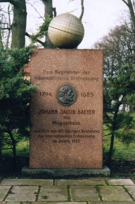

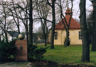
![]() Am südöstlichen Ende des Dorfangers des Berliner Ortsteils Müggelheim ist
dem Geodäten
Johann Jacob Baeyer ein
Gedenkstein gewidmet. Die Frontseite enthät eine Plakette mit
einem Porträt und von den Jahreszahlen 1794 und 1885 flankiert sowie den nachstehend
wiedergegebenen Text:
Am südöstlichen Ende des Dorfangers des Berliner Ortsteils Müggelheim ist
dem Geodäten
Johann Jacob Baeyer ein
Gedenkstein gewidmet. Die Frontseite enthät eine Plakette mit
einem Porträt und von den Jahreszahlen 1794 und 1885 flankiert sowie den nachstehend
wiedergegebenen Text:
Nach [1], S. 79 wurde das Denkmal am 6. Oktober 1962 enthüllt.
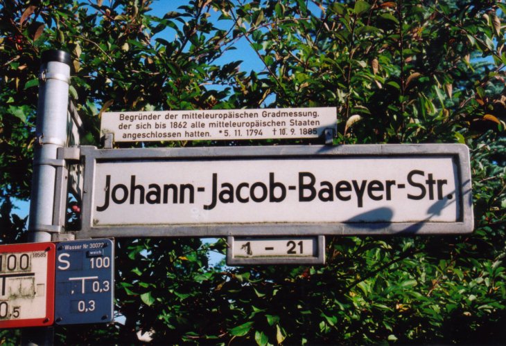
Seit 1994 ist auch eine Straße in Müggelheim nach dem Geodäten benannt. Ein Straßenschild, das noch die nachstehenden Information zeigt, ist am Ende dieser Seite abgebildet:
Das Fotos wurden im Januar 2007 und August 2008 (Straßenschild) aufgenommen.
![]() At the south-eastern end of the village green of Müggelheim there is a memorial stone
honouring the geodesist
Johann Jacob Baeyer.
Müggelheim is located in the south-eastern part of the city of Berlin. The front-side
contains a plaque with a portrait with the dates of birth 1794 and death 1885 as well as
the following text, in this case certainly translated to English:
At the south-eastern end of the village green of Müggelheim there is a memorial stone
honouring the geodesist
Johann Jacob Baeyer.
Müggelheim is located in the south-eastern part of the city of Berlin. The front-side
contains a plaque with a portrait with the dates of birth 1794 and death 1885 as well as
the following text, in this case certainly translated to English:
Possibly this translation may sound strange, but what is called international Earth surveying was the starting point for the International Association of Geodesy (IAG).
According to [1, p. 79] the memorial was unveiled on Oktober 6th, 1962.
Since 1994 there is also a street in Müggelheim named after this geodesist. A picture of a street-sign is given below. There are also some additional information provided there. It reads like:
The photographs were taken in January 2007 and August 2008 (street-sign).
| [1] | Höpfner, Joachim: Über die Geschichte des Geodätischen Instituts Potsdam |
| Back to the main page | Created by Wolfgang Volk in March 2007 Last addition on May 12th, 2015 |